by Hunt to Eat Ambassador Jason Norris
The Guadalupe River is one of 15 major rivers across the state and originates from a spring in Kerr County, TX. From there it travels 230 miles to San Antonio Bay on the Gulf of Mexico. It is a popular destination for tubers during the hot summer months.
The Guadalupe River or just "Guad" is popular for recreational fishing as well. From fly fishing for rainbows and trout to the many other species available including the state fish of Texas, Guadalupe Bass, Largemouth Bass, Smallmouth Bass, Rio Grande Cichlid, Striped Bass, White Bass and assortment of Blue Gill Longear Sunfish. This river is a magnate for angling enthusiasts from all over the country.
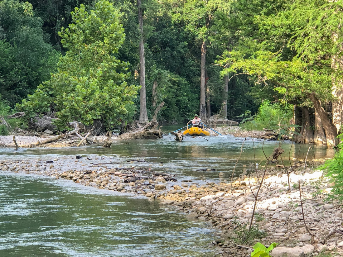
I recently joined up with folks from Orvis here in San Antonio and we floated a section of river above Canyon Dam. All public access, no guide needed and I’m going to lay it out so that you can replicate this trip if in the area.

For this trip a 13ft. AIRE raft with NRS frame was our mode of transport. Gave the room to handle 3 people, gear, coolers and ran shallow enough that low river flows in areas were not always a problem. Our fly-fishing gear consisted of 5-6wt rods with a weight forward line. You can consider going lighter such as 3-4wt but having the extra spine to handle the hard fight of bass really helps. Fly selection can be as basic as you want though there are special flies that will help in tough situations.
Fly Pattern / Size
Small Poppers 6-12
Grasshoppers 8-12
Wooly Buggers 6-10 (any color)
Game Changers 1/0 – 2
Brunch Money 8
Access Points for Trip
Both the put in and takeout sections have plenty of room for trailer and parking though at peak use they may get crowded. We put in at what is called Sisterdale Bridge. The coordinates are 29.95722 -98.71715. Depending on river flows and level will determine how much rowing is needed. We traded off roles as much as possible to keep ourselves moving at about 1.5mph. Total trip length was just about 12 miles, so it took about 10 hours. There are several resources available for info on level and flow to help determine trip length. Due to the abundance of private land, camping options are all but nonexistent on this stretch. Sometime gravel beds are exposed and safe to camp on but be careful of rain chances not just in your immediate area but for miles upstream. Flooding is rapid due to the limestone bedrock that limits the amount of water the soil can handle. For safety reasons, a 1-day trip is recommended. Takeout location was the FM 474 bridge, coordinates 29.89434 -98.67093. The Guad is known for some sections having private dams built by landowners but this section did not have any of those, so no portage was required. Lack of rain the previous few weeks had dropped the levels so that there were times when we all had to get out of the boat to lighten the load and get it past shallow gravel beds. Be cautious for fallen logs and rocks just below the surface. Regular flash floods can and do bring down debris that can cause obstacles as well.
Tips for Being Successful
If you are fishing from a raft, your best option is positioning the boat in the middle or moving closer to whichever bank you feel holds fish. The same rules apply in terms of looking for cover, points that come out and areas where flow can slow helping fish hold. Anglers should aim the flies to land no more than 4-6” from the bank. The closer the better, if you can bounce the fly off the shore, all the better. During the morning hours before the temps rise, stick with topwater action. The poppers and hoppers are deadly during this time when allowed to drift with the current. As temperatures rise, look to go deep with wet flies and streamers. The Brunch Money and Game Changer were excellent patterns, but wooly buggers and even crayfish patterns will produce strikes.
As noted, the Guad is a tremendous resource for folks looking to fly fish in Texas. There are numerous access points at low water crossings and city, county and state parks. The upper river, to include the North and South Fork are limestone bottoms and in many areas are shallow making the perfect recipe for sight casting while wading. As you move down the river, gravel replaces limestone and deeper pockets form. Kayaks, rafts and even still wading are effective approaches. As with any unfamiliar area, consult rules and regulations for fishing including where private property boundaries are. For general fishing advice on the local rivers including Comal, Blanco and San Marcos, be sure to stop into your local fly shop. I recommend the folks over at Orvis in San Antonio for all gear, tips and general great conversation.

